
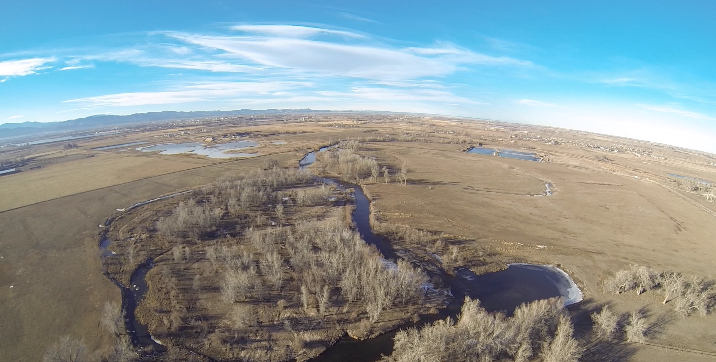
Photo was taken from approximately 500 vertical feet above ground level looking North Northwest upstream along the Cache La Poudre River (Colorado) and down on the 3-Bell conservation easement.

The bottom center of the photo clearly shows a healthy oxbow ecosystem dominated by sandbar willow and cottonwood galleries. Upstream are remnant oxbows which have been heavily degraded by human agricultural practices. Drone under control of Raymond Holz; still picture clipped from video.
